
The Odisha government has decided to install four more Doppler radars in the state soon, a decision taken at a high-level review meeting presided over by Revenue and Disaster Management Minister Suresh Pujari. Pujari said the new radars will soon be commissioned at Bhubaneswar, Sambalpur, Puri and Paradip, adding to the state’s two presently active Doppler radars at Paradip and Gopalpur. “The installation of the Doppler Weather Radar at Sambalpur is nearly complete and will be inaugurated shortly,” the minister said, adding that similar facilities at Balasore, Bhubaneswar, and Puri are to be commissioned within the current year.
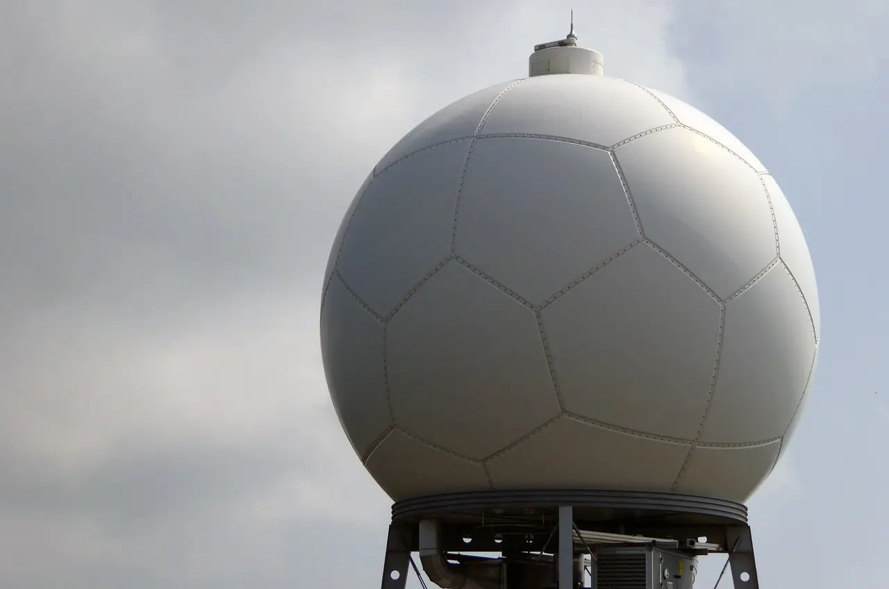
Doppler radar is scientific equipment that tracks the frequency of reflected radio wave changes, allowing meteorologists to map wind speeds, track storms, and predict severe weather such as cyclones and heavy rain. The meeting also reviewed the state’s broader disaster mitigation infrastructure, with Pujari directing all concerned departments to expedite implementation of projects under the State Disaster Mitigation Fund and National Disaster Mitigation Fund, ensuring their completion well ahead of stipulated timelines. He instructed officials to identify sites for proposed Multipurpose Flood and Cyclone Centres across various districts at the earliest, and directed that heatwave centres planned in vulnerable districts be completed and made operational before the onset of next summer. The meeting also reviewed the state’s preparedness in view of the potential impact of El Niño, with officials agreeing to maintain close coordination with the Water Resources Department to ensure optimum utilisation of reservoirs and irrigation infrastructure.
A Statewide Network Engineered for Odisha’s Specific Threats
Once complete, Odisha’s Doppler radar network will expand from its current two stations to six, creating one of India’s densest weather surveillance grids and positioning the state as the country’s third-largest Doppler radar network. Notably, the radar configuration is not uniform but has been deliberately tailored to Odisha’s distinct weather threats across different regions. Paradip and Gopalpur will continue functioning as long-range S-band coastal radars dedicated primarily to tracking cyclones forming over the Bay of Bengal, while the new Puri radar, also an S-band system, will strengthen cyclone surveillance specifically along the state’s most vulnerable landfall coastline. Bhubaneswar will receive an X-band radar suited for high-resolution urban weather monitoring, while Balasore and Sambalpur will house C-band radars designed to monitor severe thunderstorms and intense rainfall across the state’s northern and western inland districts.
This configuration is expected to enable IMD Bhubaneswar to identify precisely where a thunderstorm cell is forming, estimate its rainfall intensity, monitor its movement, and issue warnings for specific towns or neighbourhoods several hours before impact, a level of precision considerably finer than the district-wide alerts that have historically defined Indian weather warnings. For a state where Nor’westers, locally known as Kalbaishakhi storms, can develop rapidly and produce destructive winds, lightning and cloudbursts within minutes, this precision is expected to provide valuable additional time for schools, fishermen, farmers, municipal authorities and emergency services to take preventive action.
Part of a Decade-Long National Transformation
Odisha’s expansion sits within a considerably larger national radar buildout that has fundamentally reshaped India’s weather forecasting capacity over the past decade. India’s Doppler Weather Radar network has grown from just 14 operational units in 2014 to 50 today, an increase of over 250 per cent, now covering more than 87 per cent of the country’s geographical area. Under the Ministry of Earth Sciences’ flagship Mission Mausam programme, this network is being expanded further still, toward nearly 100 radars by 2031, which would make it one of the densest high-resolution weather observation systems in the world.
The tangible impact of this expansion on human safety has been striking. The death toll from tropical cyclones has fallen from approximately 7,000 during the devastating 1999 Odisha Super Cyclone to fewer than 100 in more recent comparable storms, a reduction Union government officials attribute directly to improved radar coverage, satellite integration, and mobile-based alert systems. Accurate forecasts are additionally estimated to save up to ₹1,100 crore by mitigating the costs of evacuation and loss of life during major weather events, a calculation that underscores the radar programme’s value extends well beyond disaster prevention into direct economic savings.
From Radar Data to Public Alerts: The Full Warning Chain
The radar expansion is only one component of a broader alert delivery architecture the Union government has built in parallel. Working alongside the National Disaster Management Authority and the Centre for Development of Telematics, IMD now issues severe weather alerts through the SACHET platform, with State Disaster Management Authorities distributing warnings via SMS to targeted users, supplemented by access through the SACHET website, mobile app, and global platforms including Google and AccuWeather. Since August 2021, more than 9,342 crore SMS alerts have been sent nationally, with a single cyclone event, Cyclone Montha, prompting the dispatch of 77.64 crore SMS messages in one instance.
Odisha’s own track record in this space carries particular weight given its history as one of India’s most cyclone-exposed states. The state has spent decades strengthening its cyclone evacuation systems and disaster response protocols, earning global recognition for its ability to save lives during major storms including Cyclone Fani in 2019, a reputation the current radar expansion is designed to reinforce as the state pushes toward near-total inland and coastal weather surveillance coverage.
What This Means Going Forward
With the Sambalpur radar nearing completion and Balasore, Bhubaneswar, and Puri targeted for commissioning within the current year, Odisha’s radar network is on a concrete and near-term timeline rather than a distant aspirational target. For a state that experiences the full spectrum of India’s extreme weather threats, cyclones along its coast, Nor’westers across its interior, flooding during the monsoon, and heatwaves in its western districts, the six-radar configuration represents an attempt to close weather surveillance gaps that have historically left inland and western regions considerably less monitored than the cyclone-prone coastline. Whether the expanded network delivers the three-hour advance warning capability officials are targeting will become clearer as each radar comes online through the remainder of the year, ahead of Odisha’s next cyclone and monsoon seasons.