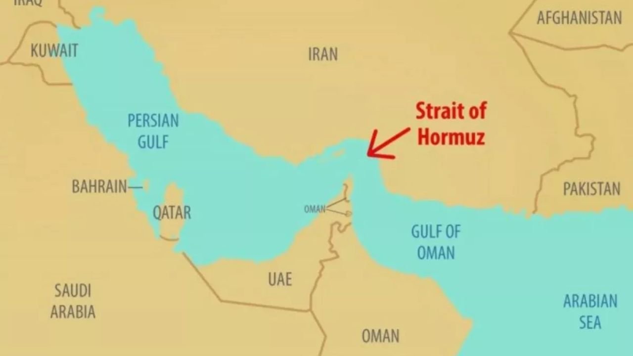
New Delhi | Amid rising tensions in West Asia, the Strait of Hormuz is facing a new kind of threat—electronic warfare. Ships passing through this critical route are increasingly showing incorrect positions due to tampering with GPS signals, significantly raising the risk of collisions, groundings, and even targeted attacks.
According to maritime experts, this is not merely a technical glitch but could indicate coordinated electronic interference. Such activities are particularly dangerous in conflict zones, where navigation errors can quickly escalate into major incidents.
FutureCrime Summit 2026 Calls for Speakers From Government, Industry and Academia
Growing reliance on GPS turns into a vulnerability
Modern shipping has become heavily dependent on satellite-based navigation systems. GPS determines a vessel’s position, direction, and speed using signals transmitted from satellites orbiting the Earth. However, by the time these signals reach the surface, they become extremely weak—making them relatively easy to disrupt.
This vulnerability is now being exploited, allowing attackers to interfere with signals and mislead ships about their actual location.
How ‘jamming’ and ‘spoofing’ work
GPS interference is mainly carried out through two techniques—jamming and spoofing:
Jamming: In this method, electromagnetic noise is generated to block genuine GPS signals. As a result, the navigation system fails to determine the vessel’s position, and screens may freeze or behave erratically.
Spoofing: A more sophisticated and dangerous technique, spoofing involves sending fake signals that appear real to the receiver. This tricks the system into displaying incorrect coordinates. For instance, a ship moving north could appear to be heading south.
Detecting such anomalies in open seas is difficult, but in narrow and congested waterways, they can prove fatal.
Higher collision risk in narrow passages
The risk becomes significantly more severe in narrow routes like Hormuz. Water depth changes rapidly, and ships have limited time and space to maneuver. Large cargo vessels, in particular, have slow turning capabilities, meaning even a minor navigational error can lead to serious accidents.
Experts warn that incorrect positioning could bring ships dangerously close to each other or push them into shallow waters, potentially disrupting global oil supply chains.
Expanding scope of cyber threats
The threat is no longer limited to GPS disruption. Critical ship systems—including engines, propulsion, and navigation controls—are also vulnerable to cyberattacks. Ransomware and supply chain attacks are emerging as major concerns for maritime security.
As one researcher noted, “The more digital and connected ships become, the more exposed they are to cyber threats.”
Training gaps and loss of traditional skills
Another concern is the limited scope of cybersecurity training for ship crews. In many cases, training is restricted to email phishing and USB-related threats, while real-world risks—like navigation system manipulation—remain under-addressed.
At the same time, traditional navigation skills are rapidly declining. Many commercial vessels no longer carry paper charts, and celestial navigation practices have largely disappeared.
Overdependence on digital systems raises alarm
Experts caution that excessive reliance on digital systems could prove dangerous. If electronic systems fail or are compromised, crews may have very limited means to independently verify their position.
In such a scenario, the growing threat of electronic warfare in a strategic and heavily trafficked route like the Strait of Hormuz poses serious risks—not only to maritime safety but also to global trade and energy security.