
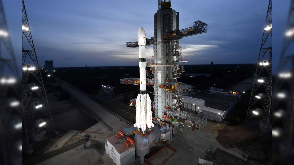

India has successfully launched its first dedicated imaging satellite designed to observe the country from geosynchronous orbit, giving authorities the ability to repeatedly photograph large areas without waiting for a conventional satellite to pass overhead.
ISRO’s GSLV-F17 lifted off from the Satish Dhawan Space Centre in Sriharikota at 2:55 am on September 4 carrying the 2,367-kg EOS-05 Earth-observation satellite.
Around 18 minutes later, the rocket placed EOS-05 into a Sub-Geosynchronous Transfer Orbit. The satellite will now use its own propulsion system to move towards its operational orbit, roughly 36,000 km above Earth.
ISRO describes EOS-05 as its first-ever imaging spacecraft intended to operate from geosynchronous orbit.
That difference in altitude and orbit could fundamentally change how frequently India can monitor disasters, agriculture, environmental changes and potentially strategically important areas.
Proposal for Conducting Cyber Crisis Drill, Tabletop Exercise (TTEx) & CCMP Readiness Exercise
Why 36,000 Km Changes How India Watches Earth
Most Earth-observation satellites operate much closer to the planet.
Satellites in Low Earth Orbit, or LEO, may fly only a few hundred kilometres above Earth. They can capture highly detailed images, but they move rapidly across the planet and therefore remain over a particular location only briefly.
EOS-05 takes a different approach.
Once it reaches geosynchronous orbit, its movement will be synchronised with Earth’s rotation. That allows it to repeatedly observe the same broad geographical region instead of disappearing beyond the horizon after each pass.
The satellite has been designed to image the entire Indian landmass roughly every 30 minutes under suitable conditions.
For selected areas, it can reportedly take images as frequently as every five minutes, an important advantage when authorities are tracking fast-developing events such as floods, cyclones or forest fires.
That does not mean EOS-05 will produce a continuous live video feed.
It means authorities can request repeated images of the same area at much shorter intervals than many conventional observation satellites allow.
What Are Geosynchronous and Geostationary Orbits?
The two terms are often used as though they mean exactly the same thing, but there is an important difference.
A geosynchronous satellite takes the same amount of time to orbit Earth as Earth takes to rotate once — approximately 24 hours.
A geostationary satellite is a special type of geosynchronous satellite that travels above the equator in a circular orbit. From the ground, it appears to remain fixed over one point.
This is why geostationary satellites are commonly used for communications and weather monitoring.
EOS-05 is being described by ISRO as a satellite for imaging from geosynchronous orbit. Its high-altitude position gives it persistent access to a much larger area than a low-orbit satellite.
There is a trade-off.
Moving farther away generally makes extremely fine spatial detail harder to achieve. The advantage is much wider and more frequent coverage.
Floods, Cyclones and Farms Could Be Watched More Closely
EOS-05 is expected to support disaster management, agriculture, forestry and environmental monitoring.
During a major flood, for example, authorities could repeatedly image the affected region and track how rapidly water is spreading.
During a cyclone, frequent observations can help show changing cloud systems and conditions across a large area.
Agricultural agencies could use repeated imagery to monitor crops, vegetation stress and changes across farming regions.
The spacecraft carries multispectral and hyperspectral imaging capabilities. These sensors examine Earth in multiple wavelengths rather than relying only on ordinary visible-light photographs.
That allows analysts to extract information that the human eye may not easily see, including differences in vegetation and surface conditions.
But optical imaging also has an important limitation.
Cloud cover can obscure the surface beneath it. EOS-05 therefore complements rather than replaces satellites equipped with radar, which can observe through clouds and at night.
Strategic Value Exists, but ‘Spy Satellite’ Goes Too Far
The mission also has obvious strategic implications.
A satellite capable of repeatedly observing the Indian subcontinent and surrounding areas could help track large-scale changes around borders, coastlines and the Indian Ocean.
The Indian Express reported that EOS-05 will have defence applications alongside its civilian uses.
But there is an important distinction.
ISRO’s official mission page categorises EOS-05 as an Earth Observation spacecraft. It has not publicly labelled the satellite a dedicated espionage platform.
Its strength is persistent situational awareness.
Low-orbit satellites can offer sharper imagery, but their predictable passes create gaps between observations. EOS-05 can help fill those gaps by keeping a much broader region under frequent watch.
Mission Revives an Ambition That Failed in 2021
India attempted something similar with EOS-03 in August 2021.
That mission failed after the GSLV’s cryogenic upper stage did not ignite successfully, preventing the satellite from reaching orbit.
EOS-05 represents the continuation of that high-altitude imaging programme.
The latest launch also came after a difficult period for ISRO’s launch programme and marked its first successful mission of 2026.
ISRO Chairman V Narayanan said the spacecraft was intended for continuous monitoring of India and nearby regions for multiple Earth-observation applications.
The real significance of EOS-05 will therefore not come simply from being 36,000 km above Earth.
It will come from how quickly its observations can be converted into usable information.
During a flood, fire or security emergency, an image is useful only if it reaches decision-makers quickly enough for them to act.
EOS-05 gives India a new way to collect that information repeatedly.
The next test is how effectively the country uses it.
What this means for you: EOS-05 could help authorities detect and track floods, cyclones, fires and agricultural changes much more frequently. But it is not an all-seeing camera: clouds, image resolution and how quickly agencies process the data will still determine how useful it becomes.
https://www.linkedin.com/company/policetechnology/